UN
133 Sefton Street
£ 209,000
Description
We don't have a Description for this property.
- Bedrooms
- 4
- Bathrooms
- 0
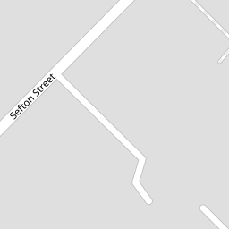


Leaflet © OpenStreetMap contributors
The heatmap indicates the level of crime in the area. The color of the heatmap indicates the crime severity and recency.
Metrics Year-on-Year
- Average area value
- 572,871.00 £Increased by 2.02 %
- Average area rental value
- 2,569.00 £/moDecreased by 19.32 %
- Est rental Yield
- 5.38 %Decreased by 20.88 %
- Crime Rate
- 1.00 %Unchanged by 0.00 %
from 561,536.00 £
from 3,184.00 £/mo
from 6.80 %
from 1.00 %
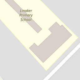
Nearby Schools
| Name | Type | Ofsted | Distance |
|---|---|---|---|
| Linaker Children'S Centre | Children's Centre | 0.06 KM | |
| Linaker Primary School | Community School | Requires improvement | 0.14 KM |
| Birkdale Primary School | Community School | Good | 0.81 KM |
| St Teresa'S Catholic Infant And Nursery School | Voluntary Aided School | Good | 0.90 KM |
| St Philip'S Church Of England Primary School | Voluntary Aided School | Good | 1.10 KM |
Images
Nearby Streets
| Name | Average Price | Average Sqft | Distance |
|---|---|---|---|
| Birch Street | £ 142,500 | 0 | 0.00 KM |
| The Walk | £ 0 | 0 | 0.00 KM |
| Wesley Street | £ 0 | 0 | 0.00 KM |
| Chapel Street | £ 0 | 0 | 0.00 KM |
| Lord Street | £ 150,000 | 0 | 0.00 KM |
Nearby Transport
| Name | NLC | TLC | Distance |
|---|---|---|---|
| Southport | 2262 | SOP | 0.99 KM |
| Birkdale | 2352 | BDL | 1.49 KM |
| Meols Cop | 2357 | MEC | 3.00 KM |
| Hillside | 2231 | HIL | 3.10 KM |
| Ainsdale | 2350 | ANS | 6.03 KM |
Nearby Listings
| Address | Price | Type | Score | Distance |
|---|---|---|---|---|
| Sefton Street, Southport, PR8 | £ 220,000 | BUY | 7 / 10 | 0.00 KM |
| Sefton Street, Southport | £ 260,000 | BUY | 7 / 10 | 0.02 KM |
| Sefton Street, Southport, Merseyside, PR8 5DB | £ 249,999 | BUY | Unknown | 0.11 KM |
| Portland Street, Southport | £ 199,950 | BUY | 6 / 10 | 0.20 KM |
| Portland Street, Southport | £ 260,000 | BUY | 6 / 10 | 0.21 KM |
Nearby Properties
| Address | Price | Distance |
|---|---|---|
| 101 Sefton Street | £ 120,000 | 0.00 KM |
| 125f Sefton Street | £ 120,000 | 0.00 KM |
| 81 Sefton Street | £ 136,250 | 0.00 KM |
| 125b Sefton Street | £ 37,000 | 0.00 KM |
| 133 Sefton Street | £ 209,000 | 0.00 KM |